Latitude Ranging
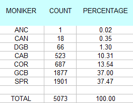
When first loaded, the Data Utility has some default Latitude values in place as an example of how the values are to be input. Click on the Find button after you have cleared any filters you might have used already. At the time of this writing, 5073 records will be returned.
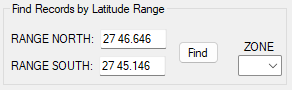
* Be aware that you may also simply elect to choose a ZONE map from the drop down list, rather than using the Latitude range.
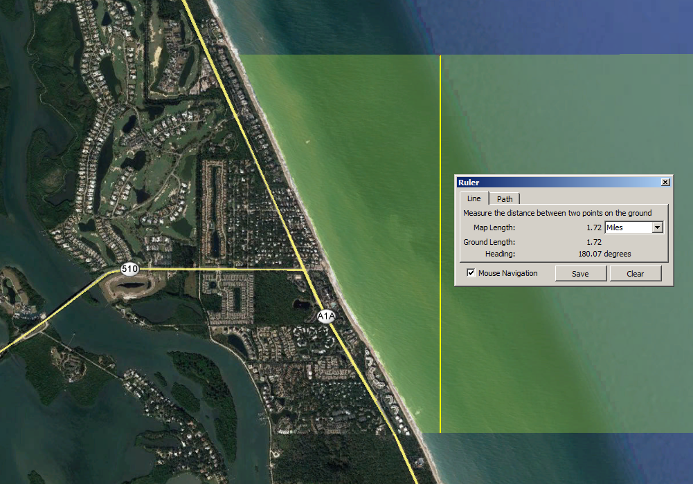
The default Latitude range is illustrated below in a Google Earth screen shot, which measures about 1.72 statute miles from south to north. In this zone, we find the Green Cabin Wreck and the Spring of Whitby. There is some question as to what other ship wreckage is found interspersed within this zone. The approximate center of this zone is Wabasso Beach where the SR 510 meets A1A.
Upon filtering this record set, you will discover that there are a number of Site attributes in question, particularly DGB and CAB. Douglass Beach is some 23 miles to the south and the Cabin Wreck is about 5.5 miles to the north. Therefore, selecting records by Site is not recommended. Latitude ranging will provide you with ALL the records in a given area, regardless of their Site attribute. This presumption is based upon Latitude values having been supplied properly. Only 2016 of the records in this set were obtained post-1999, and are presumed to be acquired via GPS.