Polar Tracking
Polar Tracking is another means of controlling the construction of entities. With Polar Tracking engaged the cursor has a tendency to travel in 45 degree increments along the X and Y plane. Polar Tracking is toggled on and off using the F8 function key on the keyboard, or you can right click in the Map Window and summon this assisting menu seen below:
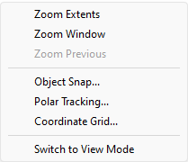
Select "Polar Tracking..."
The LiteCAD pop-up dialog for Polar Tracking will appear:
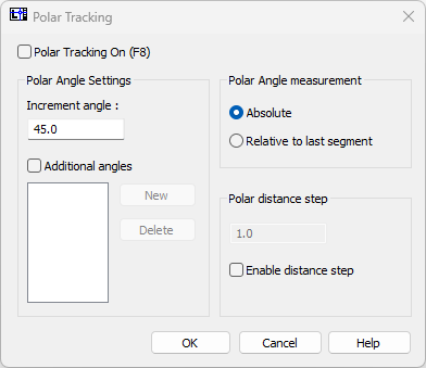
You can use any Increment angle you like however the default is 45.0 degrees with an option of Absolute. This is the most frequently used Polar Tracking setup. With Polar Tracking On, as you draw, you will see a dashed line appear whenever your cursor is on a plane matching a 45 degree angle. This would include all eight points of the compass. You can also include additional angles for Polar Tracking, but this would seldom be used with the 1715 Fleet maps.
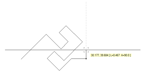
The serial lines shown below are all drawn using Polar Tracking. The last line is being drawn on a 90 degree engineering angle (see Drawing Entities for an explanation of engineering angles), which would be the equivalent of 0 degrees on the compass.