Position Markup Tools
There are two primary Position Markup tools in DigFindR.
Point of Interest
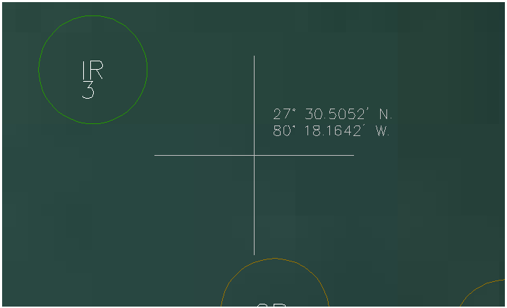
You can determine the relative coordinates of any point in the Map Window by using the Alt+X Hot Key combination. Move the cursor to the desired location, and press your Alt key as you strike the letter X on the keyboard. The position will be noted using the current coordinate system as seen in this example below:
Travel Line
You can add annotation to any selected line entity in the Map Window by using the Alt+B Hot Key combination. The Travel Line will feature its length in meters, feet, and miles, along with a compass bearing and a survey bearing (see the Manual Plotting Dialog subject for more details).
If, for example you want to know your approximate distance from shore, you would establish your position in the Map Window using the Fix Dialog via GPS, and then draw a line perpendicular to the shore and use the Travel Line function to report the distance, as illustrated below:
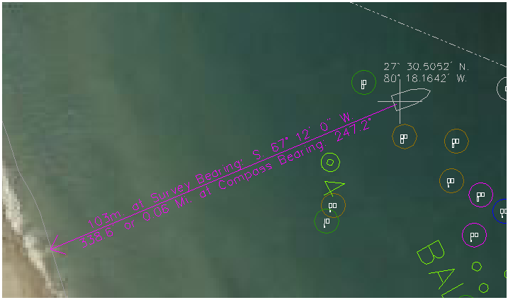
In this example, the vessel is just over 330 feet from shore. Be aware that the Travel Line's annotation will always be at a fixed scale relative to the overall length of the line being marked up, and the arrowhead will point in the direction of the bearing. If for some reason you wished to know the inverse bearing, you would begin the line at shore and draw it toward the cross symbol. When you use the Travel Line via the Alt+B Hot Key combination, the function simply reports the existing angle (bearing) of the selected line as it sits in the Map Window. While it is a quicker solution to use the Distance Measuring tool, that tool will not provide you with measurements in meters and miles as might be of interest.