Adding Shapefiles
DigFindR can import Shapefiles in the form of polylines, lines, and polygons. The attributes of these entities are not imported, leaving you to determine their line types, colors, and line widths.
Professional GIS shops and government agencies routinely produce Shapefiles for one another and for public consumption. The shapes imported by DigFindR might represent shorelines, road center-lines, political boundaries, and a host of other things that can be represented with line work. Using existing Shapefiles might save you hundreds of man-hours of labor that was already done by other draftsmen.
Shapefiles are a form of data produced by ESRI products and other similar applications as a medium of data exchange. There is no direct Shapefile import function in DigFindr. To use a Shapefile:
- Open the Layers Dialog.
- Select a layer.
- Right-click and a popup menu will appear:
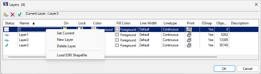
- Click on "Load ESRI Shapefile" and a Windows File Dialog will appear. Find the Shapefile you want and click on it. It will be loaded on that layer.
- If there are subordinate Shapefiles that are part of the same data set, use the Layers Dialog to create new layers and add each Shapefile to one of those new layers.
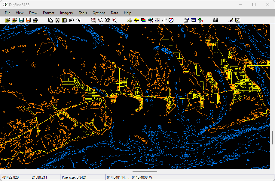
Here's a screen shot of DigFindR hosting three Shapefiles that have been imported as polylines and lines. This represents the Lower Florida Keys shoreline with road center-lines, and bathymetry.
Like aerial photos, Shapefiles are cast in particular coordinate systems and/or particular map projections. You will have to treat them like aerials to manage their geographic attributes. To do this, select all the Shapefiles on their respective layers and convert them into a single block entity. As a block entity, the Shapfile(s) can be scaled as a single unit, and rubber-sheeted as a single unit, as described in the Ground to Grid Fix topic. Once you have the block properly placed in real-world space, you can explode the block and manage the colors and line types in each respective layer.